 | ||||||||||||||
|


 |
|
[ Back to Highways Main Page ]
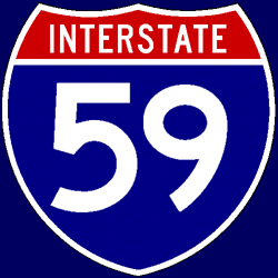 Interstate 59
Total length: 444 miles (715 km) States traversed & length in each:
Major cities along route:
Junctions with non-related Interstates:
Related loops and spurs:
Length I’ve traveled: Entire length Time zones: Counties traversed: A quick hypertext drive: Interstate 59 is a largely diagonal route through the South, paralleling the important U.S. Route 11 corridor that runs the length of the Appalachians. The short section in Louisiana and much of the route in Mississippi, at least south of Meridian, pass through heavily forested areas dominated by pine trees. In many places, trees in the (very wide) median obscure the view of oncoming traffic. The most notable feature of this southernmost stretch of I-59 is the back-to-back pair of extremely tight 40-mph curves in Laurel. A few miles west of Meridian, I-59 joins with I-20 for a 153-mile pairing that takes both highways all the way to Birmingham, AL. I-59 turns to the east here for the rest of its length in Mississippi, curving back to the northeast just after the Alabama state line. The speed limit drops to 60 mph (96 km/h) in Meridian, and the four-lane configuration is very tight; it needs to be widened pretty desperately, but there is commercial development almost up to the edge of the highway in spots. East of Meridian, I-20/59 becomes slightly hilly, contrasting with the flat terrain I-59 traverses south of Meridian. On the Mississippi portion of the multiplex, I-59’s mile and exit numbering is maintained; I suspect the reason that I-59’s numbering was favored here was that if I-20’s numbering had been maintained, the same mile and exit numbers would have been repeated just south of Meridian on I-59. (That is, using I-59’s numbering prevents duplication of those mile and exit numbers on I-20 in Mississippi.) After Tuscaloosa, I-20/59 becomes steadily more and more hilly, although I would say it never quite qualifies as mountainous. Up to the southwestern I-459 junction at McCalla, AL, I-20/59 is still only four lanes, but it is being widened to meet traffic demand. It becomes six lanes at that point, and just before downtown Birmingham, it widens to eight lanes up to the infamous “Malfunction Junction” interchange of I-20/59 and Interstate 65. (The interchange earned this moniker because both I-20/59 and I-65 cross themselves through the interchange — that is to say, you actually drive to the left of the median for a short distance — and left-hand exits and entrances abound.) Only four through lanes are maintained through this interchange. For a few miles east of “Malfunction Junction,” I-20/59 is an elevated eight-lane freeway with some very tight curves and a 50-mph (80 km/h) speed limit as it passes through the heart of downtown Birmingham. (It is for this reason that through truck traffic on I-20 and I-59, as well as I-20 or I-59 truck traffic needing to access southbound I-65, is required to bypass the city on I-459.) It narrows to six lanes and climbs a long hill up to the I-20/I-59 split; shortly thereafter, I-59 narrows quickly back down to four lanes and re-enters very hilly, almost mountainous, terrain. The highway stays in this almost-mountainous terrain until just south of the Gadsden area, where for perhaps 15-20 miles, it flattens out considerably. There is another very hilly stretch between Gadsden and Fort Payne as I-59 continues in a northeasterly direction toward Chattanooga, TN. It doesn’t quite make it there, though, proceeding through slightly less-hilly terrain into extreme northwest Georgia, and finally terminating when it meets I-24 along that highway’s very short run in Georgia. Chattanooga is accessed via eastbound I-24 roughly 12 miles from the terminus of I-59. |